GIS Surveying & Mapping

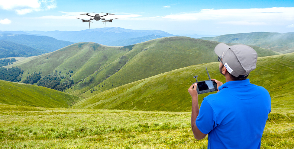
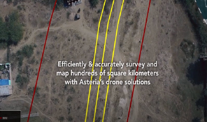
Efficiently & accurately map thousands of square kilometers using drones

GIS Surveying and Mapping Solutions

Land Surveying

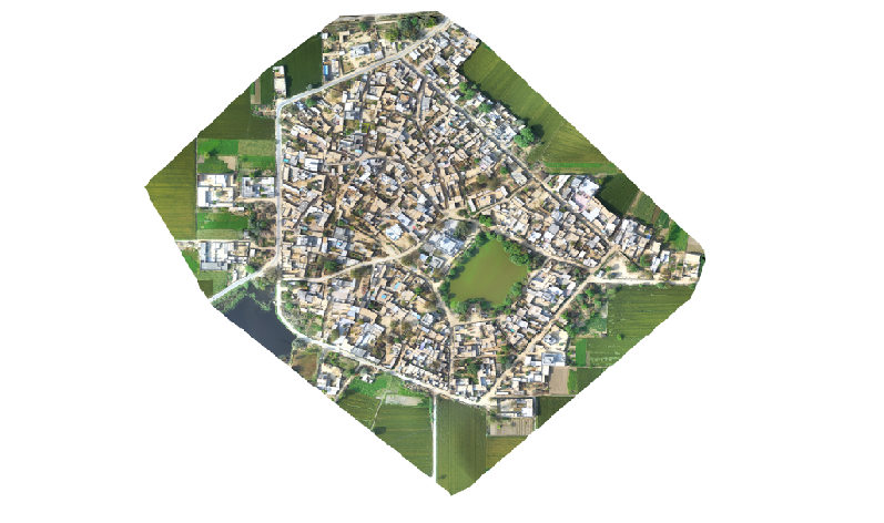
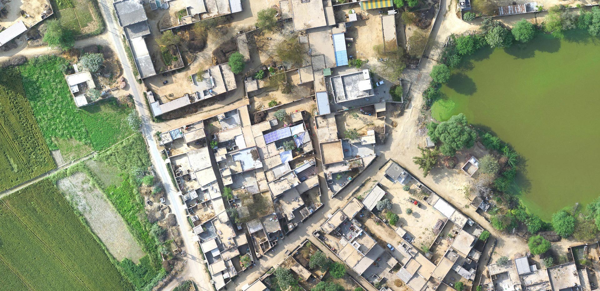
Create high-resolution maps, digital surface and terrain models to understand topography and land use patterns.

Land Management

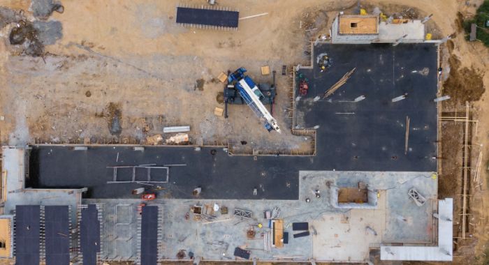
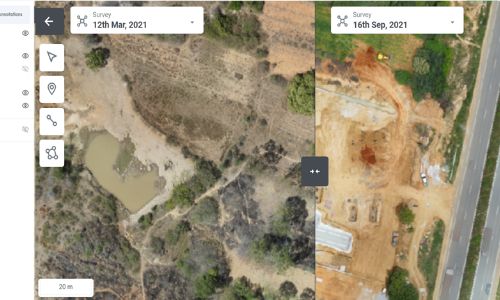
Simplify and accelerate construction site selection, design, and progress monitoring with the help of AI-based insights.

Watershed Management

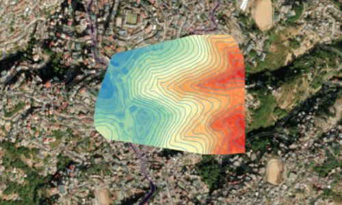
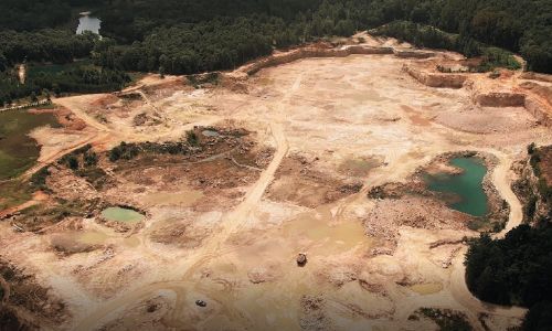
Ensure effective planning and management of watershed at scale with the help of drone data.

Our Expertise

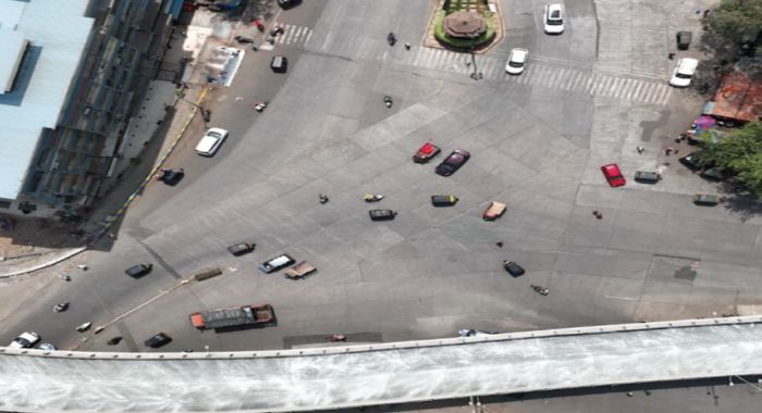
Delivering use-case specific insights from aerial mapping data.

50+ trained pilots for operations at scale.

#1 drone service provider with coverage of largest land area in India.

A complete solution with hardware, software, workflow management, training & support.

How We Deliver

Data Collection

Scale up your land surveying capabilities with Asteria’s range of survey-grade drones that can capture up to 5 sq. km in a single flight, without compromising on accuracy. Our integrated high-resolution cameras can achieve a ground sampling distance of <3 cm/pixel from a flight altitude of 120 meters.


Data Processing & Analysis

Leverage the power of hyperscale in Asteria’s cloud GIS data processing platform to stitch hundreds of sq. km of drone survey data, all through your browser, without having to purchase any high-performance workstations.

  • Use powerful ML algorithms to extract invaluable insights.
  • Share and collaborate with stakeholders and clients easily and securely.

Data Delivery

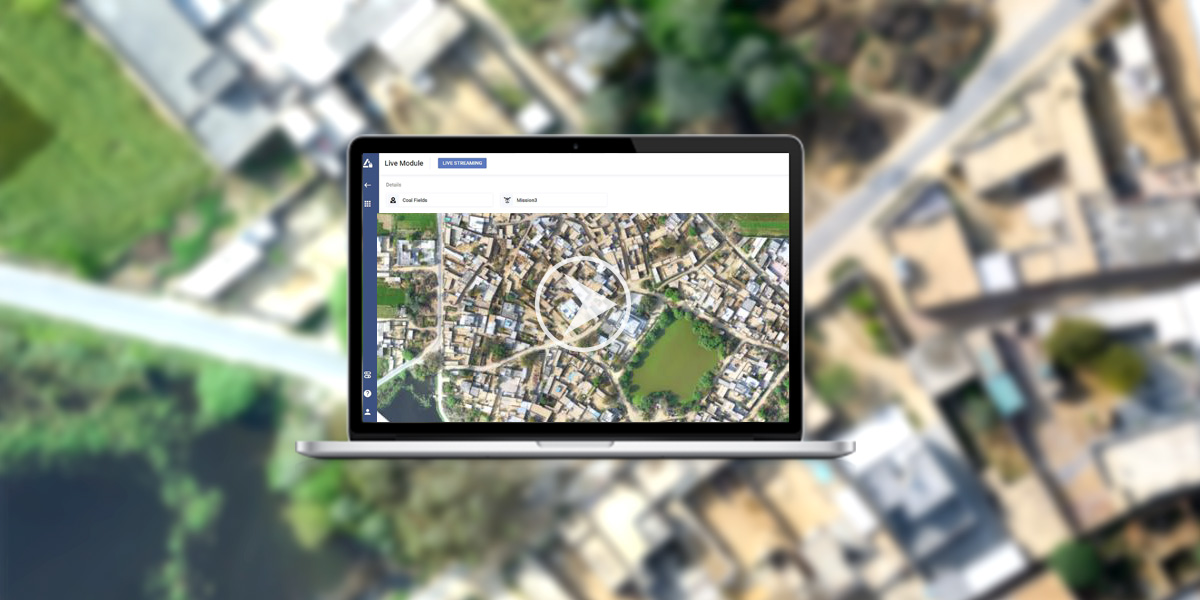
With SkyDeck, accessing high-volume GIS data is simply a click away. Load and visualize high-resolution maps in under a few seconds without the need for expensive GIS tools. Run analytics and generate reports to share with your collaborators and customers.

Benefits

icon-img

10-20x
reduction in time & cost 

icon-img

Up to 60% 
increase in collaboration

icon-img

<24 hours
from data collection to processing 

Drone-as-a-Service (DaaS)


Don't have a drone? Leverage our End-to-End DaaS Solutions

Access full-service drone capabilities on demand, without the need for investing in hardware, software, or analytics.


Know more

Customers Speak

"We are delighted to extend our sincere appreciation to Asteria team for the remarkable success in completing the SOI J&K SVAMITVA survey project in Handwara and Zachaldara Tehsil of Kupwara district. Their dedication, efficiency and teamwork ensured the project’s success and timely completion. Their hard work has set a commendable standard for future projects we are looking forward to, and we are confident that the positive outcomes will have a lasting impact on the community. The collective commitment of the team has played a pivotal role in ensuring the project’s on-time completion. Their meticulous planning, unwavering dedication, and tireless efforts have not only met but exceeded our expectations."

Shahbaz Ahmad Akhoon Tehsildar
Department of Revenue, Office of Tehsildar Handwara/Zachaldara, Government of Jammu & Kashmir

Connect with us

Require details for*

Frequently Asked Questions

Can’t find the answer here? Get in touch

What is a GIS mapping survey?
+

A GIS mapping survey is a method of collecting, analyzing, and visualizing spatial data to create detailed maps for land planning, infrastructure development, and environmental studies. It integrates geographic information with real-world coordinates, enabling precise decision-making in various industries, including agriculture, construction, and urban planning.

How is GIS used in surveying?
+

GIS surveying enhances traditional surveying by integrating geospatial data with real-time mapping. It helps in land boundary assessments, infrastructure planning, and environmental monitoring. Using advanced tools like drone GIS mapping, surveyors can quickly capture high-resolution imagery, improving accuracy and reducing time spent on fieldwork.

How does GIS differ from surveying and mapping?
+

While GIS surveying involves collecting geospatial data with advanced tools, traditional surveying focuses on precise measurements of land boundaries. Mapping, on the other hand, is the process of visualizing geographic information. GIS mapping surveys combine all three, enabling spatial analysis, 3D modeling, and real-time data integration.

What are the 5 benefits of GIS?
+

GIS mapping enhances data precision, making GIS land survey applications more accurate and reliable. It optimizes land use and resource management, enabling better decision-making. With drone GIS mapping, fieldwork becomes faster and more cost-efficient. GIS integrates multiple datasets for deeper insights and scales seamlessly to projects of any size.

Why is GIS better than paper maps?
+

Unlike static paper maps, GIS mapping is dynamic and interactive, allowing real-time updates and precise spatial analysis. It enables layering of multiple datasets, automated calculations, and seamless integration with technologies like drones, GPS, and satellite imagery, making GIS land survey projects more efficient and data-driven.

How is GIS mapping done?
+

GIS mapping involves collecting geospatial data using GPS, satellite imagery, and drone GIS mapping technology. This data is processed in GIS software, where it is analyzed, categorized, and visualized in various formats like 2D maps and 3D models. The final outputs support decision-making in land use, construction, and environmental management.