These are the most read pieces of content
New 5G rollouts, more diverse network technologies, the emergence of new business models and other market trends require telecom companies to be mo
Read More
Accurate terrain data is critical for planning and executing construction, infrastructure, and environmental projects. But what is a topographical
The mining industry is undergoing a technological shift, with drones emerging as a critical tool for enhancing efficiency, safety, and cost-effecti
Land surveying has always been a critical part of infrastructure development, real estate planning, and resource management.
Geospatial data is the foundation of modern GIS mapping with drones, enabling industries to analyze landscapes, monitor infrastructure, and optimiz
In an era where advanced surveillance and security solutions are crucial, thermal imaging drones have emerged as a game-changer.
Accurate geospatial intelligence is critical across industries, from agriculture and urban planning to infrastructure development and environmental
Unmanned aerial vehicles (UAVs) have evolved significantly, offering solutions tailored to diverse operational needs.
Drone technology has transformed industries by enhancing efficiency, data accuracy, and operational safety.
The evolution of drone technology has led to the development of various UAV configurations, each designed for specific applications across industries.
Security and surveillance have undergone a significant transformation in recent years, driven by advancements in drone technology.
The agriculture sector in India is undergoing a transformation powered by advanced drones and agriculture solutions. Agricultural drones are no lon
In recent years, drone technology has become a pivotal tool for improving public safety and emergency response efforts. From disaster management to
In agriculture, maximizing crop yield remains a constant challenge. With the rise of innovative technologies, the use of drones in agriculture has bec
When it comes to geospatial technology, orthomosaics serve as a cornerstone for accurate and detailed mapping.
Visualizing complex datasets plays a pivotal role in helping industries, governments, and individuals make informed decisions. Among the various to
The rise of drones has transformed the way industries conduct surveys and collect geospatial data. Aerial drone mapping and aerial drone surveying
Advancements in drone technology have significantly transformed how industries capture and process spatial data. What is reality capture? It refers
In recent years, drone technology has revolutionized the way industries conduct surveys and manage data. What is UAV mapping? It refers to the process
Drone technology is gradually changing how worksites are monitored and managed, offering unparalleled efficiency, safety, and accuracy.
Over the years, drones have transformed industries and continue to do so by enabling innovative workflows and unprecedented efficiency.
Geographic Information Systems (GIS) have long been the cornerstone of spatial data analysis, enabling industries to visualize, analyze, and interp
Drone surveys have become a game-changer in industries like agriculture, construction, mining, and infrastructure development amongst others.
The integration of drones into mapping and surveying workflows has redefined how industries gather and analyze spatial data.
Drone operations today extend far beyond just flying—they encompass a complex ecosystem of tasks that require seamless coordination.
The integration of Artificial Intelligence (AI) into drone software
Drones have rapidly evolved from niche tools to essential assets across various industries. Their ability to capture high-resolution data quickly,
Agriculture is undergoing significant transformation, and drones are leading the way in modernizing farming practices.
When it comes to geospatial analysis, vegetation mapping plays a pivotal role in understanding and managing ecosystems.
Drones have revolutionized multiple industries, from agriculture and construction to surveillance and mapping.
Roof inspections are crucial for ensuring the structural integrity of buildings, but traditional methods are often time-consuming, costly, and involve
Advancements in drone technology are revolutionizing various industries, making tasks like surveying, mapping, and modeling faster, safer, and more ac
Learn how drone technology is transforming volumetric measurements in industries like mining, construction, and agriculture with speed, accuracy, and
3D mapping with drones has emerged as a cutting-edge approach that is transforming how industries such as construction, agriculture, urban planning, a
Drone surveying has revolutionized the way industries capture and analyze geospatial data. Leveraging the latest advancements in drone technology and
The advent of drone technology has significantly impacted various industries, transforming how businesses operate, monitor, and manage their assets. F
Drone mapping is a cutting-edge technology that has revolutionized how we capture and analyze spatial data. By using drones equipped with high-resolut
The education ecosystem is developing at a rapid pace. It is important for education institutions, seeking to become the most sought after destination
The AT-15 drone is equipped with features designed to meet the demanding needs of modern military operations. Its capabilities ensure superior perform
GIS consultants are an indispensable part of several industries, from urban planning to infrastructure development and more. Their role involves extra
The mining industry has seen a significant surge in the adoption of drone technology in recent years. Drones have proven their versatility with a wide
The journey of aerial data from capture to insight is a critical process that holds immense value for applications across various sectors. SkyDeck, As
With growing drone services demands, the need for efficient, accurate, and timely data handling becomes increasingly critical. However, many Drone-as-
As a GIS expert, you're likely familiar with the limitations of traditional drone data processing platforms. While a lot of these tools are robust
When it comes to drone data management, annotations play a pivotal role in transforming raw data into actionable insights. SkyDeck, Asteria Aerospace&
Data processing plays a pivotal role in enhancing operational efficiency across diverse sectors. One of the key enablers in this domain is SkyDeck, a
Organizations across industries are constantly seeking ways to enhance operational efficiency, gain actionable insights, and maintain a competitive
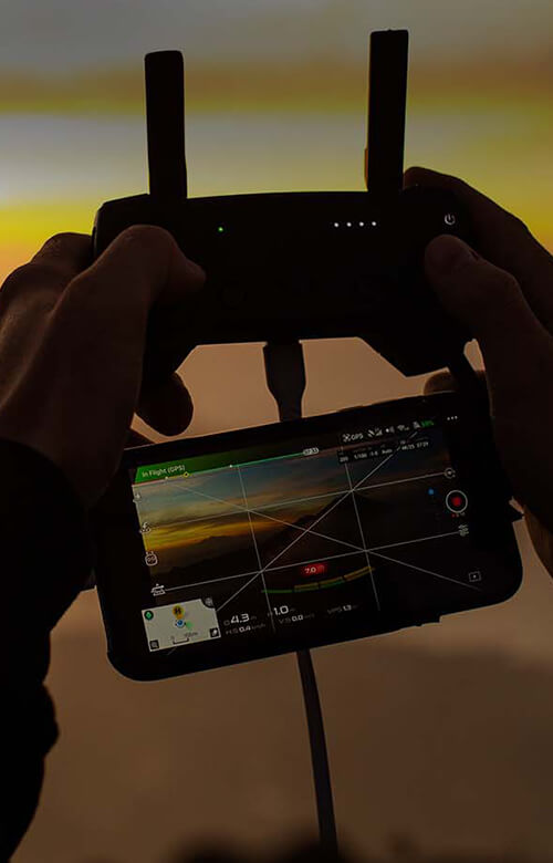
The integration of drone technology in India across industries is becoming a game-changer...
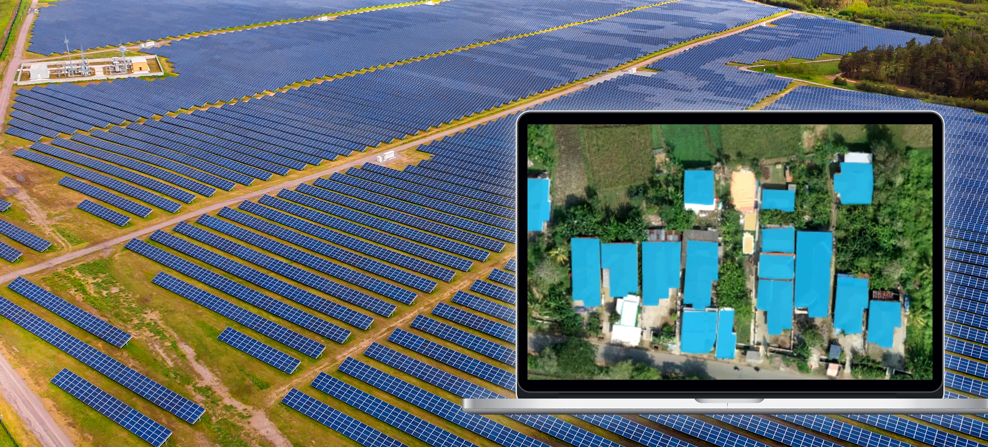
Solar energy is revolutionizing the way we harness power, and drones are playing a pivotal role in maximizing the...
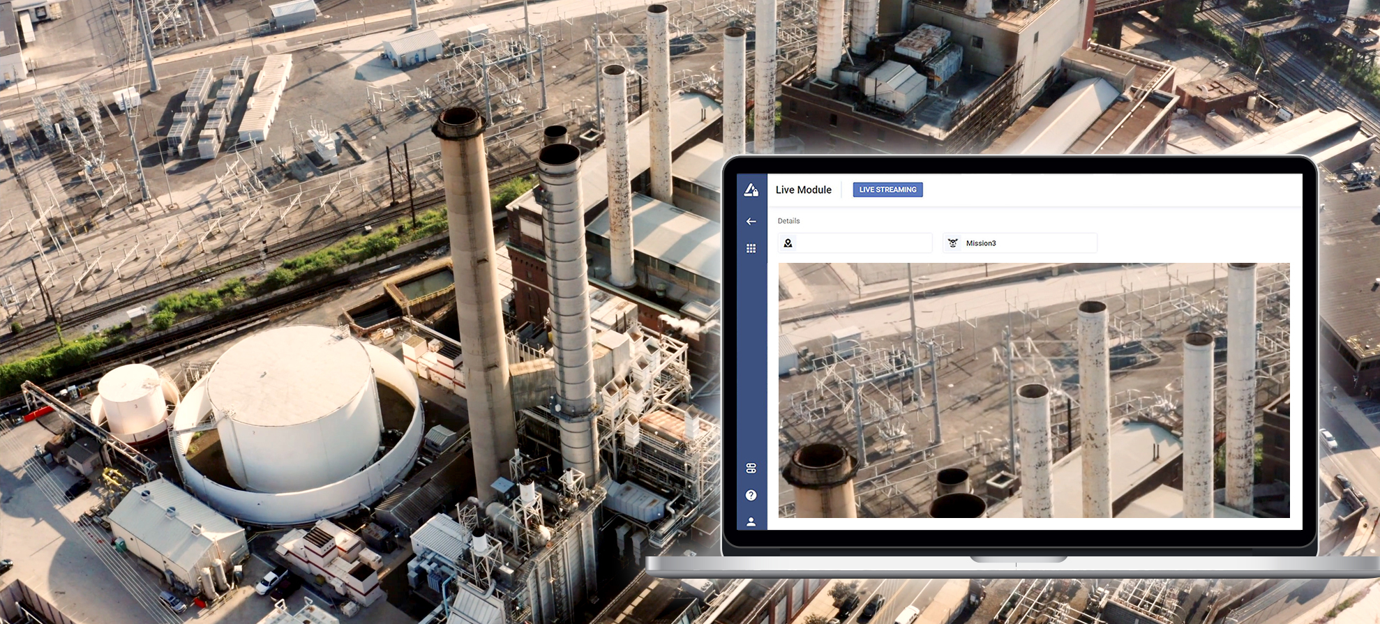
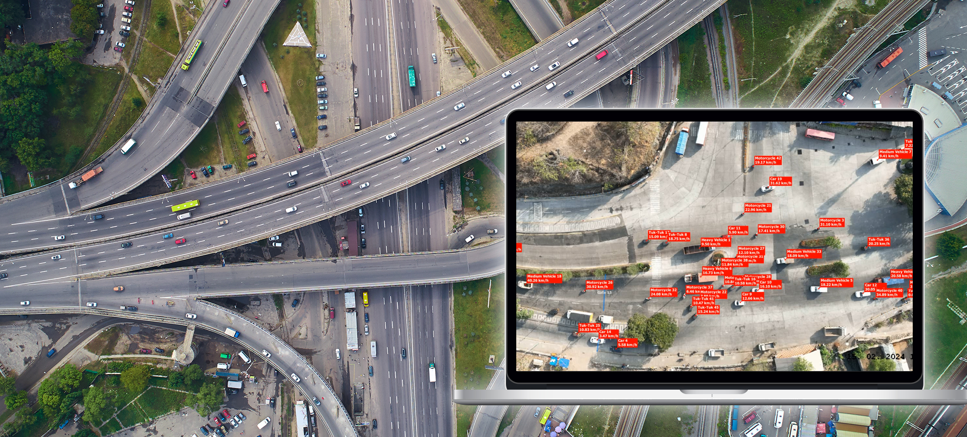
Drone technology can be used to transform multifaceted applications across infrastructure...
Drones are becoming indispensable tools in the construction industry, reshaping the way projects are planned, executed, and monitored...
Advancements in AI, machine learning, and computer vision will likely refine autonomous capabilities, enabling drones to operate with greater precisio
In recent years, the Indian drone industry has taken flight, promising transformative possibilities across sectors. From agriculture...
GIS trends 2024 and their profound implications for the drone sector: AI-Driven GIS Analysis, Emphasis on Interconnected GIS Ecosystems...
In the realm of Geographic Information Systems (GIS), precision and accuracy are paramount. As the world witnesses the rise of drone technology, GIS p
According to Adroit Market Research, the global security and surveillance market is expected to reach $84.91 Bn by 2029. Security has always been a...
As the drone industry is growing by leaps and bounds, it is expected to create thousands of new-age job opportunities for the youth of the..
The software allows you to visualize the traffic on your street or road in near real-time using high-resolution imagery.
Monitoring mines through fixed cameras or manned aircraft is inefficient. Conducting surveys with drones has several advantages.
India is one of the biggest agrarian economies in the world. A majority of people in rural India still rely on farming as the primary source of inc
The global perimeter security market size is estimated to reach USD 186330 mil...
Drone-as-a-Service significantly brings down the time to value and utilizes drones in a productized state..
Under the new drone rules, India will likely become a multi-billion-dollar market for drone operations in the next five years, and the demand and oper
Drones in agriculture effectively optimize on-field operations, increase crop yield, monitor real-time crop growth, and scout the entire field in minu
Drone technology is bringing substantial business benefits to the telecom sector. UAV technology can autonomously survey towers, create high-precision